YOUR GUIDES
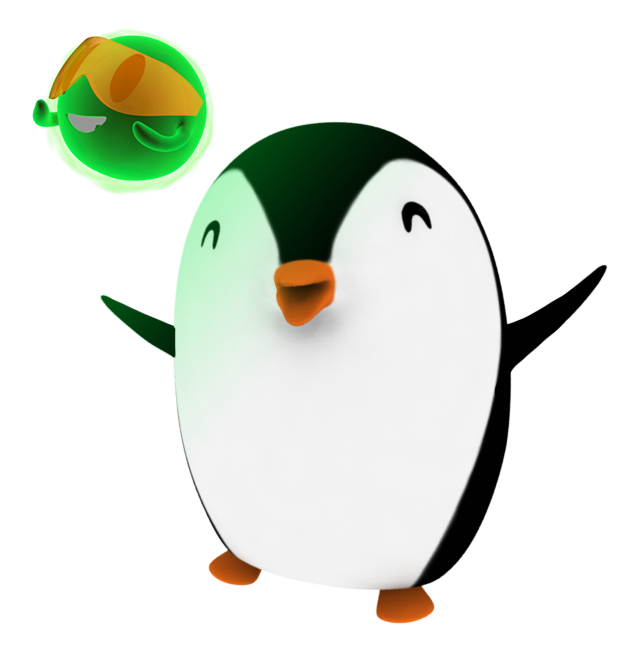
Meet Paige and Pho - your guides through the ICESat-2 FunZone! Join these two to learn more about the NASA ICESat-2 mission.
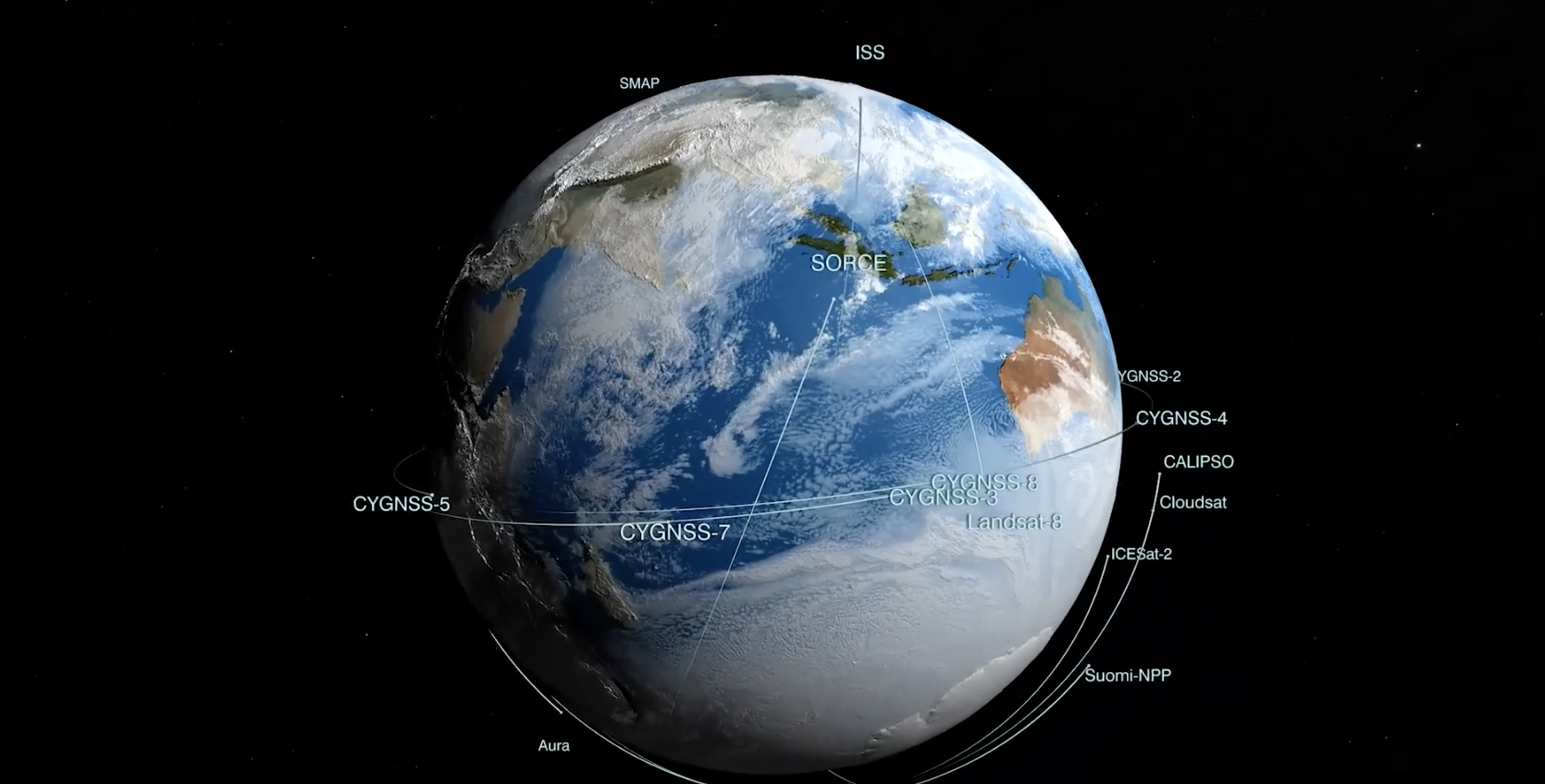
ICESat-2 is a satellite mission that measures the height of Earth's ice-covered regions to track melting and other changes. From space, it also measures the height of other features of our planet, including trees and shrubs, lakes and buildings.
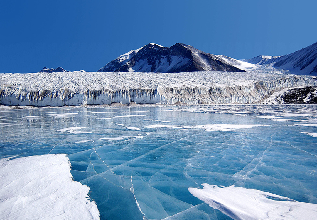
Ice comes in many forms here on Earth, like mountain glaciers and frozen lakes, but most of it is found near the North Pole and South Pole. With temperatures on our planet warming up, many of these icy areas are melting.
Videos
ICESat-2 Micro-environment Activity
You can create an ICESat-2 Micro-environment model by using common things found around your house. The ICESat-2 Micro-environment allows you to identify the Earth objects that ICESat-2 can measure, the elevation of, from space.
Breaking Down the Big Questions at NASA
The "Breaking Down the Big Questions at NASA" video is a resource that can be used alongside any activity that involves creating and developing questions. While the video focuses on questions about trees, the basic principles are necessary for asking scientific questions. The video was created for students wanting to do student research projects, who often get tangled up in the onset of their research with things problems like "what questions can I answer?" and "how do I answer such a huge scientific question?" The video discusses how to answer large research questions by starting with a series of smaller, exploratory questions that can serve as a guide to the student research and to help answer the larger, seemingly very difficult research questions.
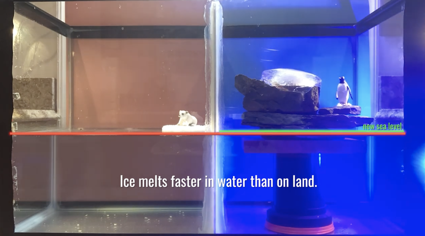
Sea Ice Vs. Land Ice: What happens when they melt?
Earth’s seas are rising, a direct result of a changing climate. Ocean temperatures are increasing, leading to ocean expansion. And as ice sheets and glaciers melt, they add more water. Over 90 percent of Earth’s ice mass is locked up in Greenland and Antarctica. As our greenhouse gas emissions warm the planet, those areas, along with glaciers worldwide, lose more ice, contributing to sea level rise.
Check out this time lapse video simulating sea ice and land ice melting in an aquarium and its effect on sea level rise.
Recreate it for yourself using common items at home!
Learn more about sea level rise on the NASA Rising Seas page.
Video Production Credit: Valerie Casasanto and Ryan Fitzgibbons
Pho the Photon in Photon Jump
Pho, a plucky bright green photon of light, must travel from a NASA spacecraft down to Earth and back again to help complete a crucial science mission in this educational short film. The animation was created and produced by media art students from the Savannah College of Art in Design (SCAD) in Georgia, in collaboration with NASA’s Ice, Cloud and Land Elevation Satellite-2 (ICESat-2) mission.
How to Build and Use a Paper Clinometer to Measure Tree Height
Brian Campbell, ICESat-2 education lead and science liaison and outreach lead for the NASA GLOBE Observer Trees Tool, and his son Andy, demonstrate how to make and use a simple paper clinometer to measure the height of trees. To do this activity, you will need a printout of the clinometer activity sheet, a straw, a pen or pencil, scissors, tape, string, and some sort of weight for the string such as a washer, nut or paperclip. A rigid surface such as clipboard or piece of cardboard may also be needed to attach the clinometer to as you are measuring the angle to the top of the tree.
NSIDC Open Altimetry Tutorial for Trees Around the GLOBE Student Research Campaign
One of the major ways students can perform student research is to compare GLOBE student and citizen science tree height data to height data from the NASA Ice, Cloud, and land Elevation Satellite-2 (ICESat-2). By comparing this data, students can see just how close the satellite tracks over their locations and if certain GLOBE-measured trees have been measured by ICESat-2. Amy FitzGerrell, from the National Snow and Ice Data Center (NSIDC) in Colorado, guided us with an interactive tutorial of the Open Altimetry online tool.
View the video on YouTube
Motion In The Ocean Activity Demo
Valerie Casasanto, outreach manager for the Ice, Cloud, and land Elevation Satellite-2, or ICESat-2, demonstrates the "Motion in the Ocean" water density activity. The materials needed are tennis ball tubes, a tub or container for excess water, salt, food coloring, tubing or a clear straw (a disassembled pen body could also work), and high density foam (such as from a children's puzzle floor mat) to make the fluid separator plugs
The NASA ICESat-2 Mission: Talking Lasers, Tree Height, and the Open Altimetry Online Tool
Brian Campbell, of the NASA ICESat-2 Team, highlights the NASA Ice, Cloud, and land Elevation Satellite-2 (ICESat-2) and its use of lasers to measure the height of Earth’s objects, like ice and trees duing this Facebook Live event as part of the Center for Science & Industry's (COSI) Virtual Science Festival in May 2020. There is also an interactive discussion on how to use the Open Altimetry online tool to view ICESat-2 tree height and tree canopy data across the globe.
Check out the video HERE!
NASA GO Trees Tool and ICESat 2 Data on Open Altimetry Tutorial
This video shows how students, teachers, and citizen scientists can take existing GLOBE Observer data for tree height and compare it to the tree canopy height data from the NASA Ice, Cloud, and land Elevation Satellite- or ICESat-2 Mission. The online Open Altimetry Tool allows you to look and see when ICESat-2 flew over or near the location of the tree you have the GLOBE data for already. It is a fun and simple thing to do and helps you become a part of a larger NASA mission.
NASA at Home: ICESat-2 and Open Altimetry
NASA's ICESat-2 uses lasers to measure heights on Earth, including tree heights. Join NASA Wallop's Brian Campbell, ICESat-2 Education Lead (and NASA GLOBE Observer Trees Science Lead) as he demos all about the satellite. Plus, learn how to look at the data coming from ICESat-2 on the Open Altimetry online tool.
Trees Around the GLOBE Student Research Campaign
We live, play and work with trees everywhere around the globe. The Trees Around the GLOBE Student Research Campaign commenced on September 15, 2018 in conjunction with NASA's ICESat-2 satellite launch on the same date at 6:02am PDT. The ICESat-2 satellite uses an on-board laser altimeter system to measure the height of Earth. Measurements of ice sheets, sea ice, trees, bodies of water, mountains are all part of what ICESat-2 measures. The Trees Around the GLOBE Student Research Campaign is a GLOBE Program campaign focusing on tree height - one of the measurements conducted by the ICESat-2 mission.
NASA GLOBE Observer Trees Snapchat Story
This is a video archive of the GLOBE Observer: Trees Snapchat story that went out on the NASA Snapchat account on March 26, 2019 as part of the release of the new Trees tool.
NASA GLOBE Observer Trees Tool Promo Video for Citizen Science
The Trees Tool in the NASA GLOBE Observer (NASA GO) app allows citizen scientist observers to use their mobile devices to take tree height and tree circumference measurements all over the globe.
NASA Reel Science 2014 Winners
Watch the high school winners of NASA's Reel Science Communication Contest. Video and original music created and performed by Anna and Geof Olson.
Launchpad: ICESat-2 - Next Generation Technology
Learn how ICESat-2 will be used to map the ice structures in the world's polar regions, allowing scientists to study changes on Earth.
Click HERE to learn more and to download the high definition video.
Real World: ICESat-2 and Earth's Cryosphere
Earth's cryosphere includes all its frozen structures, such as sea ice, ice caps, and permafrost. Understanding changes in the cryosphere provides scientists with valuable information about the past, present, and future of the planet. ICESat-2 will help scientists learn more about Earth's ice.
View the Classroom Viewing Guide!
Click HERE to see more and to download the high definition video.
Our World: ICESat-2 - What Is Ice?
What is ice? NASA and ICESat-2 scientists explain the unique and essential qualities of frozen water. Water, unlike other types of matter, is less dense as a solid than as a liquid, allowing ice cubes -- as well as bigger chunks of ice -- to float on top of liquid water. Floating ice on lakes and oceans is important, allowing life to live in the water beneath it. Ice covered regions also have a big impact on our planet's climate and weather, even far away from the polar regions.
Download the Classroom Viewing Guide.
Click HERE to see more and to download the high definition video.
Our World: ICESat-2 Measures Ice Sheets
ICESat-2 allows NASA's scientists to make accurate maps of polar ice sheets, which helps improve predictions about weather patterns, climate change, and the effects of changing ice structures.
Download the Classroom Viewing Guide
Click HERE to see more and to download the high definition video.
Activities
Echo the Bat Book
Explore the Adventures of Echo the Bat in which ICESat-2 is featured in the active remote sensing section. The book is written and illustrated by Ginger Butcher and sponsored by our Landsat partners featuring Landsat images in Arizona and ICESat-2 data over the Grand Canyon.
Sea Ice vs Land Ice Activity
See what happens when sea ice and land ice melt in this DIY activity. Note: Aquarium not required!
Motion in the Ocean for Kids: Make your own ocean in a tube
Did you know that most of the world’s oceans are interconnected and move around the Earth like a giant conveyor belt? The motion of the ocean occurs because of differences in density (heaviness) of waters. Learn how to make your own ocean in a tube with simple materials.
Sea Ice Towers
This elementary-level hands-on activity utilizes Unifix cubes (or other building blocks) and a data sheet for children to build your own 3-D model of Arctic sea ice coverage over a 41 year period. Activity also fun for adults!
16 Years of Ice Loss from Greenland and Antarctica: A Comparison Activity
In this activity, you will calculate some comparisons between ice loss and the size of a local/favorite lake, as well as an Olympic-sized swimming pool. Plus, discover how many ice cubes it would take to equal the amount of ice lost, each year, and over 16 years, from Greenland and Antarctica.
The NASA GLOBE Observer Paper Clinometer
Build a paper clinometer with simple materials like a straw and a weight, like a paperclip or a washer, and use it to measure trees.
Tree Height Comparisons: A Hand-Held Clinometer vs. the NASA GLOBE Observer Trees Tool
Taking great measurements and observations of tree height is vital to the accuracy of the science, to the comparison of the data to that of ICESat-2 and to the understanding of local to global impacts of trees on the environment. The objective is to do a comparison of the tree height measurements using a hand-held paper clinometer versus the NASA GLOBE Observer Trees Tool for citizen science and to explain any differences between the two measurement methods.
Seeing Trees in 2D and 3D: A Demonstration of Forest Extent and Tree Height
This activity uses building bricks to explain the different ways that scientists study forests from space, and why it is important to have multiple types of data.
Make your own Ice Core!
Learn why scientists need to collect ice cores by creating your own using simple craft supplies.
Bookmark Activity
Have fun with this really cool bookmark activity!
Motion in the Ocean: Full Scale Activity
The experiment demonstrates how fluids move depending on their densities.
Pho Crochet Pattern
Make your own Pho the Photon!
Photon Counting
Pretend that you are the ICESat-2 satellite! Learn about photon counting and spacecraft engineering by using green bouncy balls.
Greenland Ice
How thick is the ice covering Greenland?
Investigate this question, key to the ICESat-2 mission, with a coloring activity, then learn more about Earth’s different forms of freshwater in EO for Kids.
Build Your Own Satellite
Get creative assembling a paper model of the satellite!
EO Kids: 'Ice on Earth'
NASA Earth Observatory for Kids (EO Kids) is looking at a “cool” topic, ice on Earth.
Check it out HERE! In the issue, kids (or adults) can learn about how NASA is monitoring and measuring both land and sea ice on Earth. Plus, they can follow along and read first-hand experiences from a team of ice scientists in Antarctica in “Notes from the Field: Sledding Around Antarctica.”
Fun Links
Learn more about Earth's climate!
Earth Observatory for Kids Online Magazine with fun hands-on activities!
Explore changes in sea ice extent with this Sea Ice and the Earth System Story Map!
Manipulate a 3D Satellite with NASA Eyes on the Earth!